Map and pictures coming soon!
In 2023 I rode the Gap and C&O Canal from Pittsburgh to Washington, D.C. In 2023-2024 I rode from Fargo, ND to Milwaukee, WI, and last year I did the Lake Michigan Circle Tour, connecting Milwaukee to Chicago and Chicago to Indiana. This trip will complete Chicago to Pittsburgh, so that I will have collectively ridden from Fargo to Washington, D.C.
Palatine to Valparaiso
Day 1: 42 miles.
Since I did Chicago to Indiana last year, I'm cheating a bit and taking the UPNW train to Chicago and then the South Shore Line to Hammond, IN and starting there. It saves a day of riding that I’ve already completed.
The other part of the logistics I want to point out early is that I have designed this trip as a "credit card tour." I'm planning mostly hotel stays, but bringing camping gear in case I can't find other lodging or the camping opportunity is too good to pass up. Hotel options in northeastern Indiana are very limited. The only good way to make the rest of the miles work is to spend the first night in Valparaiso.
This deviates from the Adventure Cycling Association Chicago to New York map, which goes from Hammond to Crown Point and then across and down Indiana. Unfortunately, there is a baseball tournament of some type in Crown Point this weekend and hotels were three times more expensive there than Valparaiso, so Valparaiso it is.
The train rides today were fine. I’ve found the best way to get on the UPNW is to remove the panniers and throw them on first, then carry / lift the bike up. The South Shore Line is easier. All station platforms are at train height so you can just roll on and off.
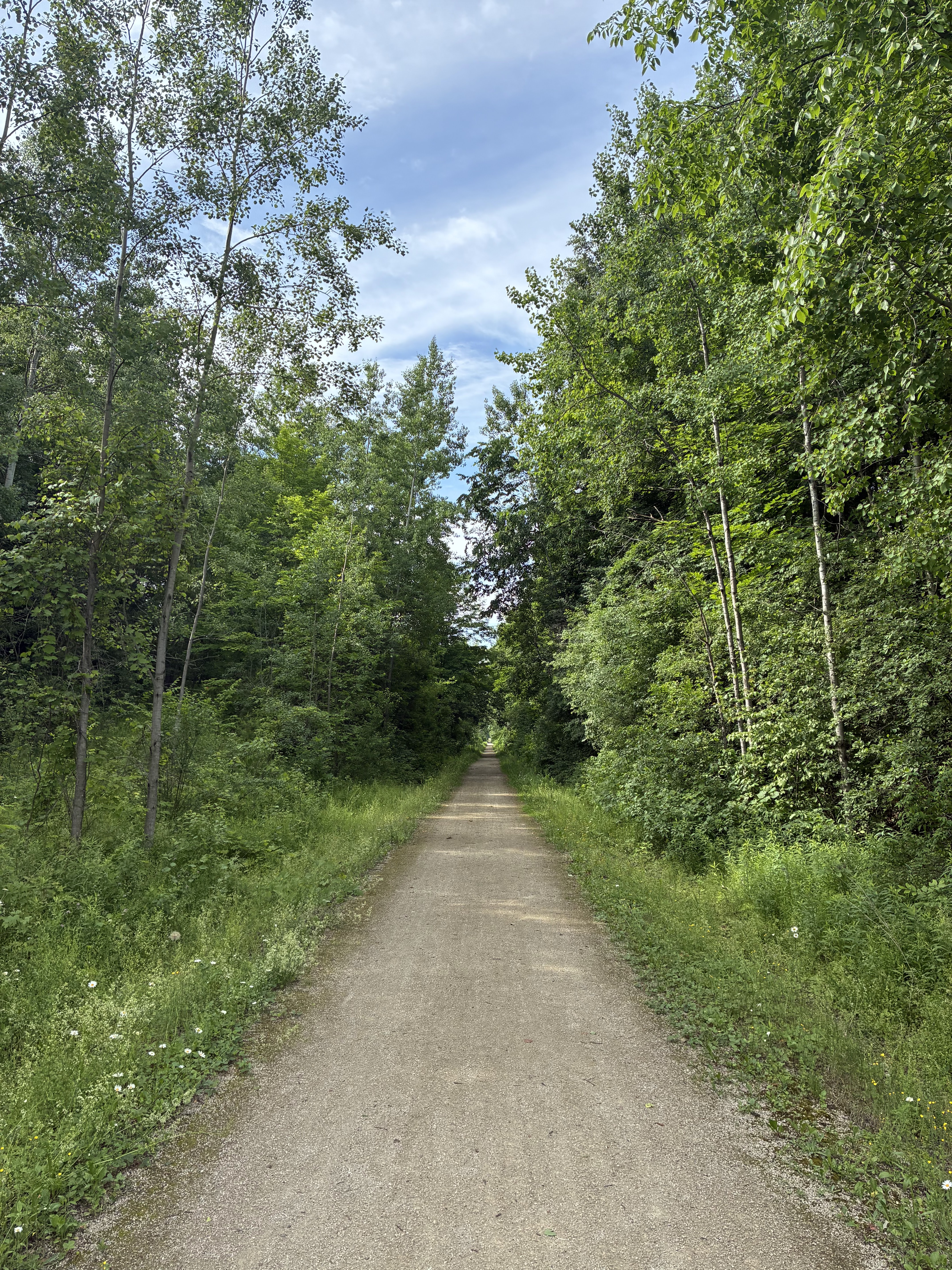
Leaving the Hammond train station, I started out by heading west. The state line is only a quarter mile away, so I crossed over into Illinois and turned around to make it a full state crossing. The first 20 miles of today's ride are very familiar. It's the same route Le Tour de Shore follows to Hobart. It includes the Erie Lackawanna Trail and the Oak Savannah Trail. Both are very nice, smooth, and paved.
I only got about an hour in before thunderstorms caught up with me. So I stopped at a Casey’s for lunch and waited out the storm. Then I continued on. Parts of Main Street in Griffith don’t have a shoulder. I’d recommend staying on the trails all the way to Hobart instead. When I got to Hobart, I followed the trail about a mile further than I should have and had to backtrack a bit.
After Hobart, I’d summarize the roads as east-west good, north-south not safe. I’m not sure why, but there was a real difference in driver behavior between the two directions. If you follow this route, look for lower-speed alternatives on the north-south passages. Once I got to the bike trails near Valparaiso, everything was fine.
The hotel for the evening is the Hampton Inn. It’s a nice hotel, but not very close to restaurants. The Fairfield Inn might be better if you want to save a mile of walking for dinner. I went to Bob Evans. It was that or Wendy’s, and Bob Evens turned out to be pretty good.
Valparaiso to Rochester
Day 2: 66 miles, 1,300 feet of elevation gain. Weather was good, relatively cool, but with a northeast wind that brought in some smoke haze and created a bit of a headwind for several segments.
Today’s route was very different from yesterday. I don’t think I would change anything about this route. It was just about as rural and isolated as one can be in the midwest. Lots of watching corn and soybeans grow. There were occasional streams, rivers, and woods as well. I did see a couple of deer, four wild turkeys, a fox, and several groundhogs.
There were a few cars here and there, but almost all of them moved over and gave plenty of space. I only remember seeing three cyclists. There were no food options near the route for the first 50 miles. I had extra water, so I was good there. I also had food, but would have selected other options if I realized there weren’t going to be any convenience stores along the way.
In all of my miles of touring, this is the first time I had to deal with an irrigation rig watering across the road. That was a new experience, and a lot of wasted water.
Hotel options in Rochester are limited. There is a Super 8 and a Quality Inn side by side. I went with the Quality Inn. Seeing them both, the Super 8 might be better. But my room was okay. I went to the Pizza Inn for dinner and it was very good.
Rochester to Marion
Day 3: 58 miles, 1,200 feet of elevation gain. Weather started out cool but got quite warm in the afternoon. There was an air quality alert as well. Every once in a while I could smell smoke, but mostly it was just hazy.
The first 25 miles of today’s ride down to Peru were wonderful. It’s a nice, secluded bike path. I saw one other rider for the whole section. Unfortunately, the trail ends about a mile from Peru and you have to take side roads into town. On the other side of town, another five or more miles are fairly busy back roads before you’re on country roads again. Then it alternates roads and trails all the way to Marion.
I don’t think I would change anything about the route, other than to note that Peru is the only real food and water option and to be sure to carry extra and/or fill up while you’re there. Wildlife was more limited today. I saw one deer with velvet antlers and one small frog. The rest were the usual squirrels, chicpmonks, rabbits, etc.
One note on hotel searches. Be sure to get Marion, IN and not Marion, OH. For some reason, my first search came up with an Ohio reservation. Fortunately, I noticed while I could still cancel it. I ended up staying at the Hampton Inn. It seems fine, but it’s a bit far north relative to the bike path and there aren’t any good food options around. I took an Uber to Don’s Tap for dinner. The beer was good, the burger was just okay.
Marion to Richmond
Day 4: 77 miles, 1,700 feet of elevation gain. Rain threatend all morning but never got heavy enough to put on a rain coat. The afternoon was sunny and hot.
Most of today’s ride was on the Cardinal Greenway. There are about 15 miles toward the north end that are back roads, but the roads are very well marked with “Share the Road” signs and all traffic cooperated. I wouldn’t change any of the route. But, beware that there are multiple sections of the trail where they have ground up the asphalt and left it as 2” loose gravel. I had to walk several sections where it wasn’t packed enough to ride safely.
There was a gas station in Matthews, plenty of food options in Muncie, and a water stop at the Losantville trailhead. That’s about it. Bring extra water and plan your food carefully. I stopped at Mr. and Mrs. B Champs sports bar in Muncie and it was good.
I didn’t see a lot of wildlife today. There was one spot where I thought I saw a deer off the trail, but that was about it. I didn’t see any cyclists in the morning. I did meet an adventure cyclist at the last trailhead before Richmond. He was headed north. He started in Washington, DC and was going to Seattle. He gave me some suggestions for Ohio and West Virginia, and I returned the favor for Indiana and Illinois.
There are a lot of hotel options in Richmond, but most of them are further east than I wanted. I chose the Baymont. There is quite a hill to get to the hotel from the trail, but it seemed better than an extra five miles riding. Dinner was at Bob Evans again, and it was very good.
Richmond to Cincinnati
Day 5: 72 miles, 3,500 feet of elevation gain. The weather was very cool today. Low to mid 70s for the high and a strong tailwind. The first 50 miles of the route were great, very remote and little traffic. After I crossed the Miami River and hit Blue Rock Road it became very stressful. Blue Rock is fairly narrow, twisty-turny, hilly, no shoulder, and almost constant traffic. Everyone who could moved over. There were several times where I bailed out onto the grass or a driveway to avoid a beer truck or similar.
Once I got into Cincinnati, it was a bike lane on a six-lane street. Safe, but still very stressful. Busses were the worst part, because the bike lane was also their lane. So, 50 good miles and 20 miles I wouldn’t repeat. If you follow this route, consider other options for the last 20 miles into Cincinnati.
Now for the good parts. Once I got down to the Ohio River, I stopped for a snow cone. Right after that, I saw an adventure cyclist waiting for his friend. He had just completed his ride down the OTET from Cleveland. We talked rides for 15 or 20 minutes until his friend was close enough to go meet up.
The hotel this evening is the Hampton Inn in Newport, Kentucky. It turns out the hotels on the Kentucky side of the river are half the price of those on the Ohio side. Also, anyone coming this way, there is a Purple People Bridge across the river that is closed to vehicles. Joggers, pedestrians, and bikes only. Much less stressful.
For dinner I went to the Hofbrauhaus. While waiting in line, the gentleman in front of me was also alone and I asked if it was okay for me to join him. He said yes, and it turns out that he has a computer background and works in electronics equipment sales for the medical industry. He is retiring later this year. He and his wife have five grown children and 18 grandchildren. All are very successful in their fields. It was great to share stories and enjoy dinner together. Food and beer were both excellent. The Hofbrauhaus is highly recommended.
Cincinnati to Xenia
Day 6: 70 miles, 1,500 feet of elevation gain. The weather was sunny and cool to start with and warm in the afternoon with a moderate headwind. Today was my bonus day. The Little Miami River Trail is supposed to be the best part of the OTET, so that was the reason for riding to Cincinnati instead of Richmond directly to Xenia.
Regarding the route, be sure to download the official route from the OTET website. That includes a flatter route and any construction detours. Both Google and Ride With GPS wanted me to do extra hundreds of feet of elevation gain leaving Cincinnati. The official route is a little longer, but stays at river grade the whole way.
Unfortunately, I didn’t get a good night’s sleep last night and was very tired today. So, while the route is certainly pretty, I didn’t enjoy it as much as I might have. The afternoon was more of a grind. Turn on the tunes and get it done.
The first part of the route is heavily used by bikers and pedestrians. Very different from the Indiana ride. The usage lightens up a bit as you go north. Interestingly, I’ve also seen more recumbant bikes on this trail than I have anywhere else.
I met three guys on e-bikes who were also headed north. They were following a stop-for-food-and-beer-frequently approach. They’d stop, I’d pass them. I’d stop, they’d catch up and stop to eat and/or drink, etc. Last I saw them they had stopped for dinner and still had 30 miles to go.
I stopped for lunch at Ramsey’s in Loveland, which is highly recommended. The hotel for the evening is the Hampton Inn in Xenia. There is a Butterbee’s restaurant across the street. The food was very good but the service was slow.
Xenia to Columbus
Day 7: 71 miles, 1,400 feet of elevation gain. The weather was more of the same, cool in the morning and warm in the afternoon. The headwind was lighter today. I only really noticed it in the morning. It did get cloudy after noon, which helped hold down the heat somewhat. I got sleep last night, and did a much better job of stopping for food and drink today.
Along the way, I met a young man who had all of his worldly posessions with him. He even had his dog behind his bike in a trailer. He said they were ultimately headed for South America. He had just started out from Cleveland and was becoming familiar with the pains-in-different-places part of adventure cycling. I shared some suggestions on seat adjustment he could try and then wished them well.
The first 40 miles of this route have some type of rest stop every 10 miles or so. Then it gets very limited until downtown Columbus. The last 10 miles into Colubus are “interesting”. Part of it is on-road bike lane. Part of it has homeless encampments in the woods, etc. I didn’t feel unsafe, but there was at least one rider headed the other way who was very uncomfortable.
I stopped at Jimmy John’s downtown for a late lunch. Then rode on to north Columbus. North of downtown the route follows Interstate 670 with multiple crossovers. Be aware that these intersections can be dangerous on a Friday afternoon. I encountered a pickup driver who was convinced that 10 seconds of his life was more important than the entire rest of my life.
My intent was to get to Westerville, but there weren’t any hotel options available, so I stayed at the Hampton Inn in north Columbus. It adds six miles to tomorrow’s journey. For dinner I went to BJ’s Restaurant. It was the opposite of last night. The service was good but the food was disappointing. Not recommended.
Columbus to Millersburg
Day 8: 81 miles. 1,700 feet of elevation gain. More great weather. It was cool in the morning and then sunny and warm in the afternoon. Fortunately, most of today’s trail was in the shade.
Today was a long day. The further east you get in Ohio, the harder it is to find lodging of any type, especially hotels. Millersburg has a few, so that was the destination. This part of the OTET is less used, but still very well maintained. It was essentially 30 miles gradual uphill, 30 miles gradual downhill, 5 miles up, and then 16 down or flat.
I didn’t meet a lot of people on the trail today. There was a couple at one of the trailheads and a few more cyclists along the way. I continued to see almost as many trikes and recumbants as I did regular cycles. What was new today after Mount Vernon was a significant Amish presence. I saw some horse and buggy combinations, but by far they were mostly riding cargo ebikes. Dozens and dozens of them.
Also interestingly, the trail has separate designated sides for horses and bikes. And as I approached Millersburg, the surface changed. The bike side was smooth and the horse side was crushed gravel. That was really interesting to see, but it certainly makes sense in terms of protecting the surface. It’s probably easier on horse hoofs as well.
For lunch I stopped at Dave’s Cosmic Subs in Mount Vernon. It was very good. Dinner was at East of Chicago Pizza in Millersburg. Service was outstanding and the food was good. The hotel for the evening is the Holiday Inn Express. The manager there is very good.
Millersburg to Atwood Lake Park
Day 9: 45 miles. 3,100 feet of elevation gain. Weather was still good. Humid in the morning, cloudy and not as hot as it could have been in the afternoon. Millersburg is the point where the OTET heads north and I headed east.
I considered at least four different ways to get to Pittsburgh from the OTET. There is a USBR 50 that heads east from Westerville. For some reason, none of the routing apps I use thought that was a good option. Google wanted me to do shoulders on high-speed roads. I’ve done that and I don’t enjoy it. Ride With GPS takes a very rural approach and I decided to go with that.
Today was very low traffic, particularly the first 30 miles or so. But boy howdy did the hills make up for it. There were at least seven significant climbs today, each with 200 feet plus in elevation gain. The slope was also challenging. I think I walked up the steepest part of four hills. I can sustain 7% to 8%. I can manage 9% to 10% for short periods. Today’s hills were hitting 14% to 15%. Just get off and push.
Today was Sunday. And in this community, it meant everyone was at church. It was neat to see all of the horses and buggies lined up outside the Amish gatherings. And the ones who weren’t there were at the Mennonite church down the road. I stopped there to get water and got a smile from one of the ushers. Another 10 miles down the road I stopped at another church and got more water and blessings as well. There are advantages to Sunday morning rides.
I stopped for lunch at Subway in Dover. This evening is camping at Atwood Lake Park. The lake is very much a boating destination. There appeared to be at least a hundred boats in the marina. The campground has 600 spaces. The first 100+ are pretty well spread out and more primitive. The other 500 are typical RV spaces and pretty close together. It’s a nice campground and has Wi-Fi. The only caution is that a lot of the primitive sites are not level. I had an early dinner at the camp store and then went swimming in the lake.
Atwood Lake Park to Collier
Day 10: 61 miles, 3,600 feet of elevation gain. Weather was hot and humid. This was my toughest day of adventure cycling so far. The first few miles were climbing out of the lake area. Then maybe 20 miles on Route 212. Route 212 is relatively high traffic and not bike friendly. I thought I would say that part was the worst. It wasn’t. There was more to come.
The second part of the route is about 15 miles on a nice bike trail. I stopped at the Jewett Family Diner for breakfast and it was very good. After that I followed USBR 50 for awhile. That was relatively low traffic and seemed fine. But somewhere Ride With GPS turned off USBR 50 and took me into the middle of nowhere. I ended up on some gravel power line maintenance road. Then that got flooded and I got to wade through foot-deep swamp water. Then climb / push the bike up two 500-foot elevation gain roads, one gravel, one paved. The downhill in the middle had to be walked for part of the way because it was too steep to break safely.
After I got to Wellsburg, I crossed over the Ohio River into West Virginia. That had a nice bike path, for a while. Then it was shoulder. Then it was 55 MPH and no shoulder. Sigh. Eventually I turned off WV 2 to climb / push up another 500 foot elevation gain hill for lodging.
Here’s where the day got better. Mike and April McCann are WarmShowers hosts. There is no camping and very little other lodging in this part of West Virginia, so they are a popular cyclist stopover destination. And rightly so. They welcomed me into their family for the evening, and we went to a relative’s house for a pizza and ice cream celebration for a family member.
I had a warm shower, dinner, and got to camp comfortably in the back yard garden. And I must have been tired. There were storms overnight but I only woke up long enough to close the rain fly flaps and then went back to sleep. The birds didn’t even wake me at dawn.
Collier to Pittsburgh
Day 11: 42 miles, 1,600 feet of elevation gain. The weather cleared long enough for me to pack up and have breakfast. April made eggs and potatoes. Then we said our goodbyes. The rain started just as I was getting onto the road. Leaving their house is an easy ride, straight down. And it wasn’t too wet, so I had traction for breaking.
The Panhandle Trail through West Virginia to almost Pittsburgh is very nice. Most of it is paved. Some of it toward the Pittsburgh end is limestone / two track. But the rain was light enough that I didn’t need a jacket and the ride was good. Until I stopped for a snack.
During the gravel adventure yesterday, the back tire went almost flat. I pumped it up and it held until morning. I pumped it up again this morning and it held, but looked a little low. So, I took the cap off to add air and the valve stem came out. Instant flat that broke the bead on the tubeless tire. I knew it was done, so I took it off and put in a tube instead. That worked. 30 minutes later I was on the trail again.
Getting into Pittsburgh is roads. Not bike friendly roads. But at least they aren’t high speed roads. I wasn’t in the mood to trust Ride With GPS today, so I followed Google. That was an adventure. It was ultimately a good route, but it took me down a street that turned into little more than a foot path through well overgrown vegetation. Along the way there were two major (200+ feet elevation gain, 15% maximum grade) climbs to walk / push up. Somewhere in there the sky broke open and I was drenched. The good news is I was cooler and I didn’t lose traction or get run over.
Anyway, I made it safely into Pittsburgh and came out at Point Park at the Three Rivers confluence. It’s a beautiful area. Pittsburgh downtown is very bike friendly. I talked to some locals and then at their suggestion headed to Mike’s Beer Bar across the street from Pirates Stadium for dinner. Then I headed to the train station for the ride home.
Pittsburgh to Palatine
Day 12: 3 miles. The train was delayed two hours due to trees down across the tracks somewhere further east. We got on about 2:30 a.m. I’ve mentioned it in previous blogs, but many Amtrak trains have roll on bike service you can reserve for $20. You are the first to board because you have to get your bike to the baggage car and then get yourself on board. You lift your bike up to them, no panniers allowed, and they rack it for the journey. Then you pick the bike up at the baggage car at your destination stop.
This is my first trip getting a roomette sleeper and traveling first class. The roomette layout is interesting. It took awhile to figure out what was most comfortable. The upper bunk is about six inches wider, so I ended up there. I think I got about four hours of sleep. Not bad under the circumstances.
Then I went for breakfast and had scrambled eggs and potatoes. I sat with a man who is a college literature professor. It turns out that he has found long train rides to be both an inspiration for his own writing and a perfect opportunity to do the writing. He has also writtten fiction about academic affairs from the perspective of a moderate / liberal educator working in a conservative patriarchical college. After breakfast he headed off to finish this trip’s chapter.
While I was at breakfast, the condutor / attendant converted my room from bed to seating. I was able to enjoy a private window view the rest of the way to Chicago while finishing up my own writing. Then a short train ride back to Palaine and pedal three miles home.
Epilogue
12 days, 690 miles, four miles of elevation gain. Looking back, Indiana seems quiet, tame, and secluded. Except for any specific parts noted above, I enjoyed the Indiana portion. I wouldn’t repeat the 20 miles into Cincinnati. But I would absolutely repeat my great dinner there.
The OTET is one of the nicest bike trails I’ve been on. It reminded me of Day 2 in Minnesota south of Fargo and Day 3 in Michigan. It’s better than the Katy Trail or the GAP from a standpoint of being relatively flat, paved, and well-maintained. The views aren’t as good as those trails, but Day 1 on the OTET in particular is very nice.
I wouldn’t repeat the last two days in Ohio. There has to be a better route, and Ohio needs to do a much better job of marking it, marketing it, and protecting cyclists. Assuming a safe route can be found, I would absolutely stay with the McCanns again. They are wonderful people.
The West Virginia to Pittsburgh part is fine. The two climbs to get into or out of Pittsburgh aren’t fun, but otherwise it’s a nice ride.
I have now connected Fargo, ND, to Washington, DC. And I’ve checked off Indiana, Ohio, and West Virginia border to border. 17 states done. Panhandles count, because I’m the one who’s doing the counting!